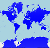
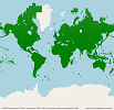
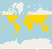
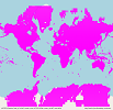
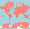
Here you can see the global coverage of the different Digital Elevation Models as generated and uploaded per 2021-12-29
(click on the picture for larger view):
You can download new elevation data manually as described below:
Instructions:
- Follow the links below to download the elevation tile catalogue first (according to your Digital Elevation Model)
- Unzip the catalogue and open it with a suitable text editor (huge file!). The catalogue contains all subsquares available
for this elevation model. - Check out which subsquares are needed and available
- build the download address (see below) and download the ZIP file manually
The URL for download is created this way:
http://www.airscout.eu/downloads/ScoutBase/1/ElevationData/[Digital Elevation Model]/[Field]/[Field]+[Square].zip
where [Digital Elevation Model] is either GLOBE, SRTM3, SRTM1, ASTER3, ASTER1
Example for download of the GLOBE Elevation ZIP file for JO50IW (containing JO50AA ... JO50XX):
http://www.airscout.eu/downloads/ScoutBase/1/ElevationData/GLOBE/JO/JO50.zip
Here are the links to the catalogues for each Digital Elevation Model:

